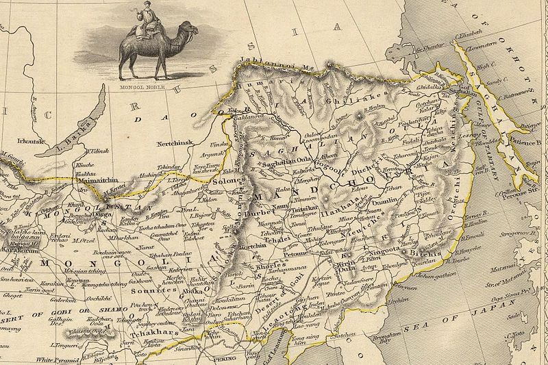
ფაილი:John-Tallis-1851-Tibet-Mongolia-and-Manchuria-NE.jpg

ზომა წინასწარი გადახედვისას: 800 × 533 პიქსელი. სხვა გაფართოება: 320 × 213 პიქსელი | 640 × 427 პიქსელი | 1 024 × 683 პიქსელი | 1 280 × 853 პიქსელი | 2 100 × 1 400 პიქსელი.
თავდაპირველი ფაილი ((2 100 × 1 400 პიქსელი, ფაილის ზომა: 2,34 მბ, MIME ტიპი: image/jpeg))
ფაილის ისტორია
დააწკაპუნეთ თარიღზე/დროზე ფაილის დასათვალიერებლად, როგორც ის მაშინ გამოიყურებოდა.
| თარიღი/დრო | მინიატიურა | ზომები | მომხმარებელი | შენიშვნა | |
|---|---|---|---|---|---|
| მიმდინარე | 03:10, 7 დეკემბერი 2009 |  | 2 100×1 400 (2,34 მბ) | Vmenkov | {{Information |Description={{en|1=The NE section (Manchuria and Mongolia) of the map of the northern and western part of the Chinese Empire - "Thibet, Mongolia, and Mandchouria". The borders are shows as per the 1858 treaty of Aigun. The main Russian cent |
ბმულები
ამ ფაილზე ბმული მოცემულია შემდეგ გვერდებზე:
ფაილის გლობალური გამოყენება
ეს ფაილი გამოიყენება შემდეგ ვიკებში:
- გამოყენება als.wikipedia.org-ში
- გამოყენება ar.wikipedia.org-ში
- გამოყენება bn.wikipedia.org-ში
- გამოყენება ca.wikipedia.org-ში
- გამოყენება cs.wikipedia.org-ში
- გამოყენება cv.wikipedia.org-ში
- გამოყენება da.wikipedia.org-ში
- გამოყენება de.wikipedia.org-ში
- გამოყენება en.wikipedia.org-ში
- გამოყენება en.wiktionary.org-ში
- გამოყენება eo.wikipedia.org-ში
- გამოყენება es.wikipedia.org-ში
- გამოყენება fa.wikipedia.org-ში
- გამოყენება fi.wikipedia.org-ში
- გამოყენება fr.wikipedia.org-ში
- გამოყენება hy.wikipedia.org-ში
- გამოყენება id.wikipedia.org-ში
- გამოყენება it.wikipedia.org-ში
- გამოყენება ja.wikipedia.org-ში
- გამოყენება kk.wikipedia.org-ში
- გამოყენება ko.wikipedia.org-ში
- გამოყენება la.wikipedia.org-ში
- გამოყენება lt.wikipedia.org-ში
- გამოყენება mn.wikipedia.org-ში
იხილეთ, ამ ფაილის გლობალური გამოყენება.

